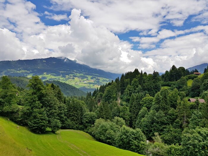
Although Vorarlberg is the smallest province of Austria, it’s very diverse. I spent a week traveling through the state, crossing no less than five different regions and covering things like a mountain lake, a monastery, and the famous Milka chocolate outlet. Below, you can find all I’ve done as well as where I’ve stayed along the way.
Contents
- Day 1: Hiking around the Lunersee
- Day 2: Hiking the Gauertaler AlpkulTour in Montafon
- Day 3: Milka, meditation, and a waterfall hike
- Day 4: Hiking between gypsum holes and picking herbs in Lech
- Day 5: Nature meets ar(t)chitecture in the Austrian Bregenzerwald
- Day 6-7: Kleinwalsertal: a hike, a garden and the end of the world
- How to travel to Vorarlberg
- Don’t forget travel insurance
Day 1: Hiking around the Lunersee
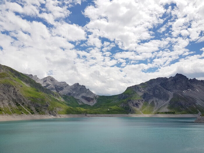
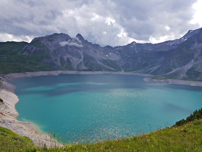
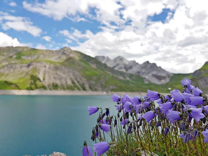
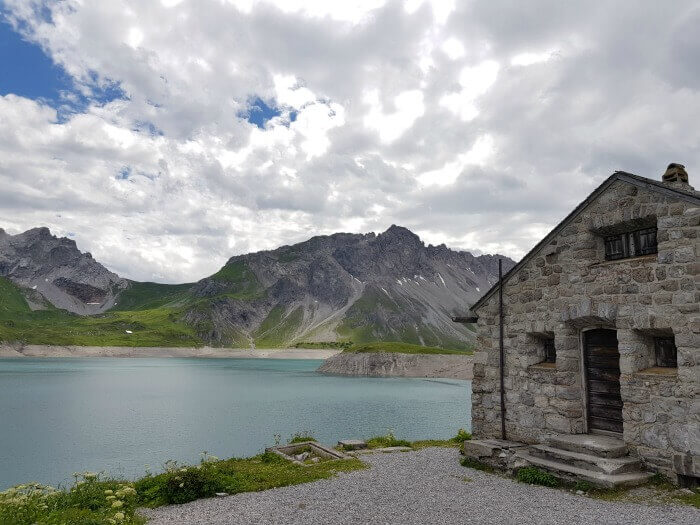
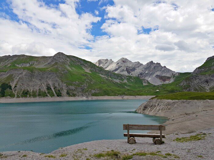
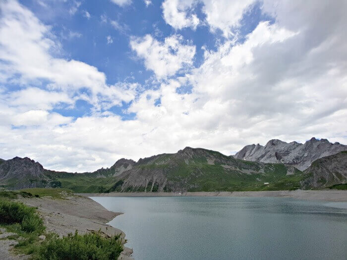
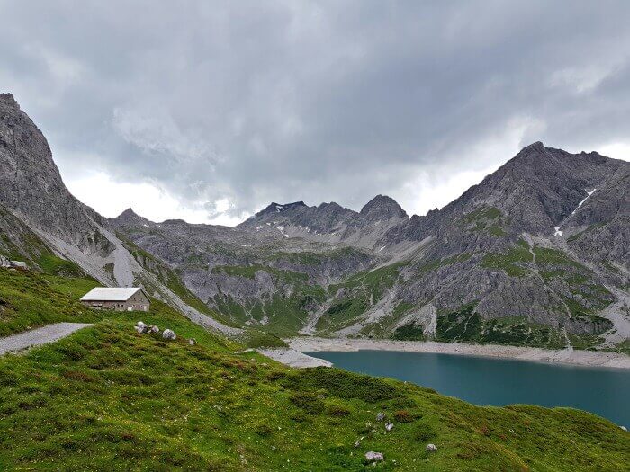
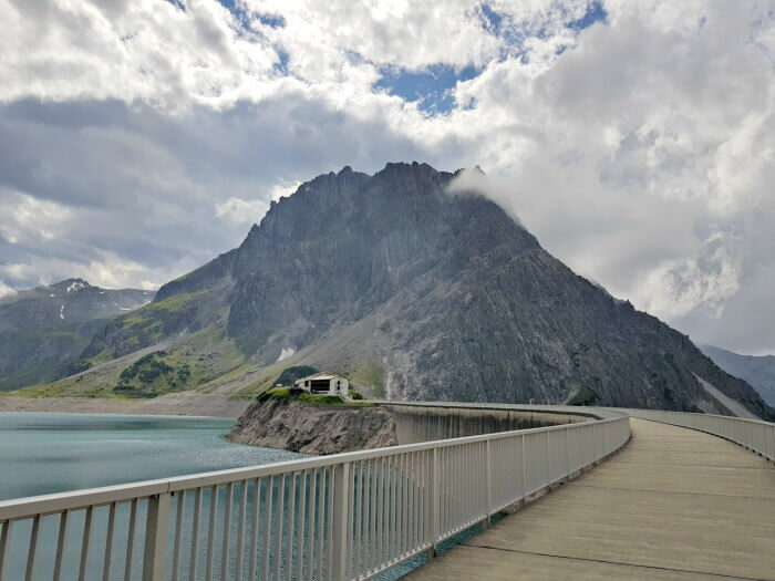
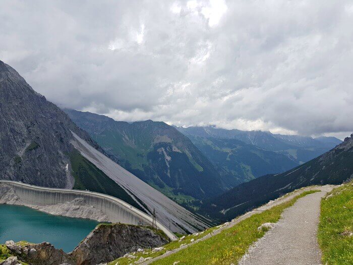
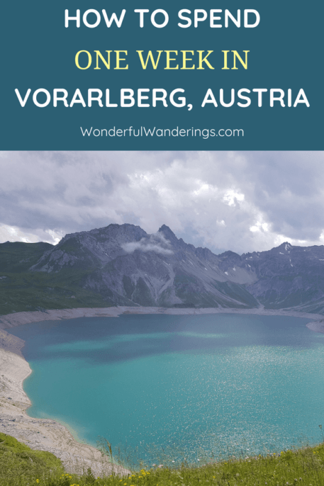
On the border of the regions Brandnertal and Montafon in Vorarlberg, lies the Lunersee or Luner Lake. Once a purely natural lake, its depth was increased by 72 meters by the construction of a hydroelectric dam in 1958.
Don’t let that fool you, though: aside from that dam and the cable car station, this area is dominated by the mountain scenery of the Ratikon range.
While it is located at 1,970 meters above sea level, the Lunersee isn’t just a place for daredevils. Yes, you can go climbing here, but there are also different hiking trails and some even bring their rods for a peaceful afternoon of fishing.
Why I was there?
The Lunersee was my first stop on a week-long trip around the Austrian Vorarlberg region. There were quite a few hikes on the program and the loop trail around the Lunersee proved to be the perfect warmer-up.
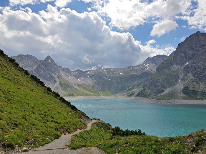
The loop path goes around the lake and covers 6.1 kilometers. Because most of the trail goes over flat or almost-flat ground, it’s categorized as an easy hike and I confirm that it is.
There are a few things to take into account though.
Tips for hiking the Lunersee loop-tail
When you get out of the cable car station (more on that later), you have the option to start the trail either left or right. I went right and that is the flattest, easiest part of the hike. The path stays relatively flat until you reach the back of the lake, where things get a bit more hilly.
At this point, you’ll need to let your muscles work a bit, but nothing more than if you’d be walking on a bit of a hilly street.
The final quarter or so of the hike – if you’ve started on the right when facing the lake at the cable car station – is the only part that might be considered a bit tricky. While the path is still pretty wide and easy to walk on, it does get pretty steep at one point.
As this part is the highest part of the trail, it’s also where you’ll get the best views.
The hike is estimated to take someone with a normal physical condition 1.5-2 hours without any long breaks. I did it in about 1 hour and 20 minutes and while I did take a lot of photos, I also have to say that I walked pretty fast.
That’s because I arrived at the Lunersee in the afternoon and had to make it back to the Lunerseebahn, the cable car station, in less than two hours, or I wouldn’t be able to get down again.
In hindsight, I could’ve walked slower and I still would have made it.
So where should you start, left or right?
If you’re traveling with kids and/or pushing a stroller or a wheelchair, I recommend starting to the right when facing the lake and possibly skipping the final part. Pushing anything up there will be hard. If you do want to have a go at it, I recommend bringing one of those light strollers that you can just flap shut and carry while you carry/drag your kid over the final bit.
In any other case, I’d recommend doing the opposite of what I did and starting on the left side. That way, you can take all the time you need on the harder part, especially to take lots of photos. If you’re a bit in a hurry, it’ll also be easier/more pleasant to hurry over the flat part at the end than if you’d have to do the steep part when rushing back to the cable car.
Practical information to hike around the Lunersee
Getting to the Lunerseebahn
To get to the Lunersee, you’ll need to take the Lunerseebahn (the cable car), which you can reach either by car or by bus. If you take the bus, you’ll need to take line 81 if you’re staying in Brand, like I did, or along the way. The bus doesn’t come that often though and times change depending on the season, so make sure to check them beforehand.
If you’re driving, you need to take into account that the last bit of the route is along a rather narrow mountain road and while it’s perfectly easy to drive on, there is a chance that you’ll have to give way to someone coming from the other direction somehow. There’s a large parking lot in front of the Lunerseebahn station, so no need to worry about that.
I walked the trail in sturdy sneakers and that was fine but don’t forget to bring sunglasses and sunscreen as there’s no shade.
Taking the Lunerseebahn
At the time of writing, the Lunerseebahn goes up every 30 minutes from 8 a.m. to 12.20 p.m. and from 1.10 p.m. with the last ascent being at 4.55 p.m and this from May 15 until October 15. It goes down every 30 minutes from 8.10 a.m. until 12.15 a.m. and from 1 p.m. with the last descent at 5 p.m.
When it’s really busy, they might skip their lunch break, but best not to count on that.
Tickets can be bought at the entrance of the Lunerseebahn and cost €12.20 (return ticket for adults) at the time of writing. There are discounts for seniors, children, and groups. If you get the Montafon-Brandnertal Card, your ride is for free.
Food and drinks
If you do the loop trail around the Lunersee, you’ll pass by two places where you can get something to eat or drink. The Douglas Hütte is located right by the cable car station and is open from 7 a.m. until 10 p.m. daily from May 15 to October 15.
The Lünerseealpe should offer local products, but it wasn’t open when I was there and I couldn’t find any opening dates or times for it either. So if you’re pressed for time and don’t think you’ll be able to stop at the Douglass Hütte, it’s best to take a small snack with you.
Where to stay in Brand
I spent the night at Hotel Sarotla where I enjoyed a lovely dinner as well as a breakfast buffet in the morning.
The hotel offers free WiFi and is located next to the golf course in Brand. All rooms have their own balcony, a television, and modern bathrooms. Bathrobes are provided. You’ll need those to make use of the spa area which has a Finnish sauna, a steam bath, an infra-red cabin, a solarium, and a hot tub. The relaxation room offers a panoramic view of the mountains and massages can be booked as well.
Want to stay at Hotel Sarotla as well? Check here for more reviews, prices, and availability.
Pin for later
Day 2: Hiking the Gauertaler AlpkulTour in Montafon
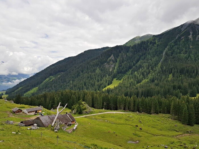
After my warm-up hike around the Lunersee, I was ready for some heavier work. The Gauertaler AlpkulTour is a loop-trail in the Montafon region of Vorarlberg, Austria that takes hikers past 13 different stations or installations.
Each of these stations encourages you to reflect on the landscape and teaches you something about the pastoral way of life in the area and the history of the Alps. They were created by the local artist Roland Haas.
While the trail is well-indicated, it’s not indicated as being the AlpkulTour route, which I found a bit confusing at first. Luckily, I had the map of the route you can find on this page and so I knew which direction to follow based on the names of the places on the map.
I’ll share some more practical information about the trail in a bit. Let me tell you about the actual hiking experience first.
My experience hiking the Gauertaler AlpkulTour trail
The AlpkulTour trail covers a distance of 12.8 kilometers, ascending 332 meters and descending no less than 1,232 meters. The official estimated time for walking it is 4 hours and 40 minutes. That’s without a lunch break and there are a few stops along the route where you can get that lunch break.
The first is the fifth of the stations I mentioned earlier. It’s a hut called Alpe Latschätz where they produce the regional “Sura Kees” which you can also buy there. The hut has some tables out so you can have a drink and some cheese there if you like.
The second is the Lindauer Hütte. This is a proper hotel with a restaurant and a large terrace where you can get all kinds of typical Austrian dishes as well as small snacks, dessert, and drinks. I enjoyed a lovely salad and a coffee here.
If you take the red route on the map back, you’ll pass two other huts as well and as usual, there are restaurants by the cable car stations too.
Anyhow, back to the trail!
I started hiking around 9.45 in the morning and got back to the car around 2 p.m., so I’d say it’s safe to count 4-5 hours including a short lunch stop.
The trail is categorized as being of medium difficulty but I found it very doable, and I’m not an experienced hiker at all. I think the degree of difficulty is mostly due to the fact that there are a few steep parts and that there’s a long descent if you follow the red route back to the parking lot.
You definitely need good hiking boots for this trail, but the path is pretty decent everywhere. It’s more a matter of not slipping in the mud when it’s wet or sliding away when walking on the grind part after you’ve passed the Lindauer Hütte.
While the stations along the route are definitely cool, they’re not what make the hike. The landscape is. Yes, do look out for the works of art and if you understand German, you can scan the QR codes by each of them for some additional information, but mostly look around you.
The landscape is fantastic.
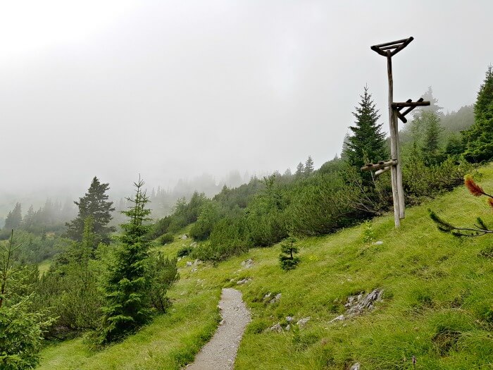
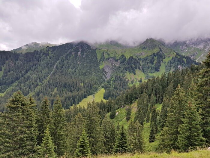
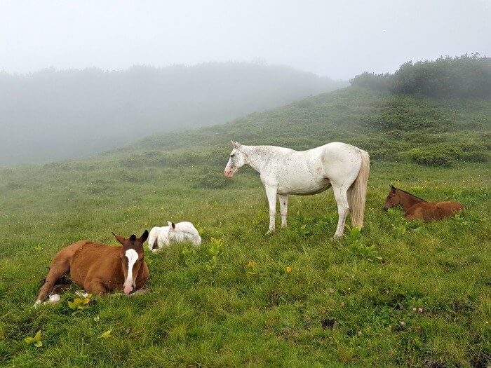
When I started in the morning, it was pretty foggy and a haze drifted over the mountainsides below and above me. Suddenly there was a herd of horses, quietly grazing next to the path.
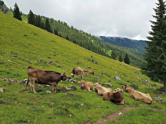
As the skies cleared, the bells of the cows seemed to sound more cheerful and I can’t help but admit that I was a bit impressed when walking in between these large but gentle animals. Little did I know that a few months later, I wouldn’t be walking in between them, but with them during the annual Almabtrieb.
Yes, you will come across cows and maybe even horses along this walk. Don’t worry, though. They’re used to seeing hikers and will leave you alone if you do the same.
Practical information to hike the Gauertler AlpkulTour
Getting there
The easiest way to start the AlpkulTour trail is to drive to the Latschau cable car station (Latschaustrasse 62, 6774 Tschagguns) and take the cable car up. Don’t make the same mistake I first did and get out at the first top: you need to get out and then immediately get back in again to go one cable car station higher, to Gruneck. This is where you’ll start your hike.
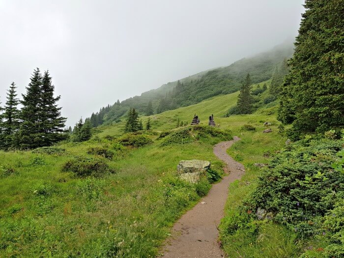
Those spikes in the center are the entrance gate to the trail
It’s also the only point where you need to pay attention and follow the right trail. As I mentioned, the arrows don’t say “AlpkulTour” and the entrance gate to the route mentioned on the plan isn’t visible from the cable car station.
What you do is this: get out and take the exit to the left. Walk a bit up until you reach the point with the direction signs where the path splits in two. Take the path to the left. From there on, it’ll be easy.
If you follow the yellow route, you’ll take the cable car back one station further down, at Matschwitz. If you follow the red route like I did, you’ll walk back down toward the Latschau cable car parking lot.
There’s a big free parking lot at the entrance of the cable car station and another, smaller one to the left of it (you need to get to that one via another road). When I arrived in the morning there was still ample space, but when I got back around 2 p.m., it was pretty much filled up so take that into account when you plan your day. I’d recommend starting the hike in the morning so that you’re not pressed for time and you’ll have the trail more to yourself.
Taking the Golmerbahn cable car
The Golmerbahn is the cable car consisting of different parts. There’s a part between Vandans and Latschau and then one between Latschau and Gruneck which also stops at Matschwitz.
It operates throughout the day, but opening times do depend on the season. Check here for up-to-date opening times.
A ticket for one section of the Golmerbahn costs €9 for an adult at the time of writing, while a day pass costs €18. There are discounts for seniors, children, and groups.
Where to stay near the AlpkulTour trail
I spent a night at the 3-star family-run Hotel Zimba in the town of Schruns, less than 15 minutes from the Latschau cable car station. It’s a classic hotel with super friendly personnel and excellent service.
After a day of hiking and exploring, guests can use the wellness area with a sauna, solarium, and indoor pool. Bathrobes, slippers, and towels are provided.
Want to stay at Hotel Zimba as well? Check her for more reviews, prices, and availability.
Pin for later
Day 3: Milka, meditation, and a waterfall hike
The Milka outlet in Bludenz
On my third day in Vorarlberg, I was supposed to do a culinary hike in the Grosses Walsertal, a biosphere park, but it was gray and raining. So instead, I made a few stops on my way to Lech, where I would spend the night.
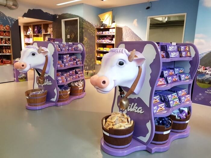
My first stop was in the town of Bludenz at Milka Lädele, the outlet of the Milka factory in Bludenz. It has a tiny Milka museum and a Milka shop where you can buy all kinds of Milka chocolate.
I wouldn’t say the prices are low here (more like normal) but they do have a very big selection of Milka chocolate flavors and different kinds of Milka chocolate products, like Milka chocolate bars and Milka chocolate eggs.
Before you get into the store part, you pass through a very small exhibition with all kinds of Milka attributes, such as the famous Milka chocolate cow.
When I visited Bludenz, I was actually just too late as each year at the beginning of July, the town hosts a proper Milka fest. I don’t know how much there is to it, but if you’re a proper chocolate fan, you might want to take that into account when planning your vacation in Vorarlberg.
Practical information for visiting the Milka Outlet
The exact address is Milka Lädele, Fohrenburgstraße 1, 6700 Bludenz.
There’s a parking lot in front of the outlet where you need to pay with coins at a ticket machine. If you’re traveling by public transportation, the outlet is right across the street from Bludenz train station.
There’s no entrance fee.
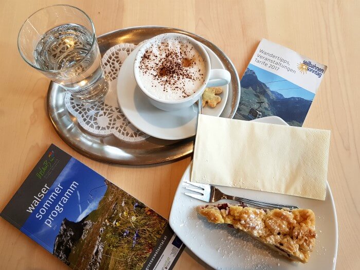
Coffee and cake at the biosphärenpark.haus
My next stop was the biosphärenpark.haus in Sonntag, also in Alpenregion Bludenz and part of the Grosses Walsertal. It’s located right in front of the Seilbahn Sonntag (Sonntag cable car) and originally the plan for the day had been to take the cable car up from there to do a hike to two huts where I’d have a bite, before coming back down to end the day with coffee and cake at the biosphärenpark.haus.
Because of the rain, I decided to skip the hike and get straight to the coffee and cake.
Aside from a cafe with local foods, the biosphärenpark.haus also has an exhibition space that gives you some information about the biosphere park. If I recall correctly, it was all in German, but there were plenty of visuals as well. Lastly, there’s also a small cheese factory but it isn’t always operational.
Hiking in Bad Rothenbrunnen
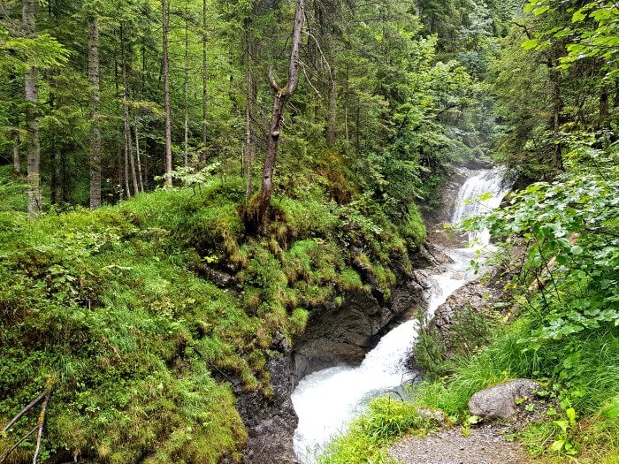
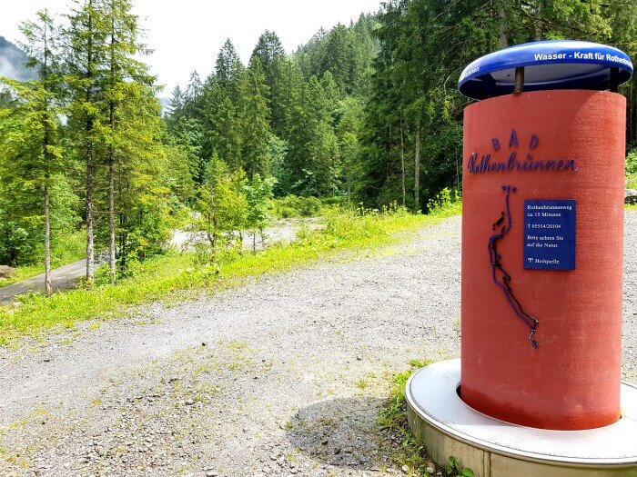
Also in Sonntag, there’s a waterfall that you can hike along to get to a guesthouse. As it was only still drizzling when I left the biosphärenpark.haus, that’s where I went next. I’ve left directions to get there below and the hike itself is very well indicated.
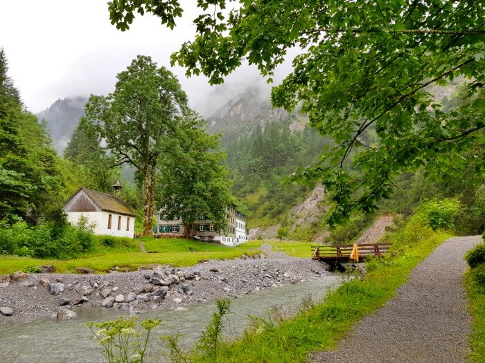
From the parking lot, you just follow the path upward along the water until you reach Alpengasthof Bad Rothenbrunnen. You’ll get some nice views along the way and Alpengasthof Bad Rothenbrunnen is located in a pretty picturesque place as well.
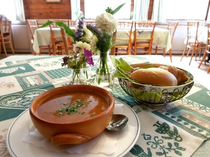
I was told the cake is delicious here but as I’d already had some, I ordered a soup which was good too.
The Alpenhof lies on a spot where several trails come together, so you can always visit it as part of a bigger hike as well.
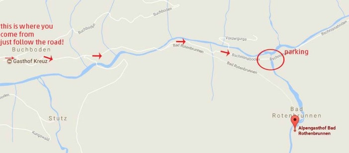
Practical information to hike to the Alpengasthof Bad Rothenbrunnen
Alpengasthof Bad Rothenbrunnen, 6731 Sonntag / Buchboden
Drive to Sonntag and there, turn right in the direction of Buchboden. When you arrive at the village, after Hotel Kreuz, you turn right to pass Gasthof Jäger and then follow the road. It looks like you’re going wrong but just go on. You drive along a small river and through the woods until you stop at the parking. From there it is a 15 minutes walk along the waterfall until you reach the Alpengasthof – much shorter than the waterfall hike in Zillertal I once went on.
Visiting the Propstei St. Gerold
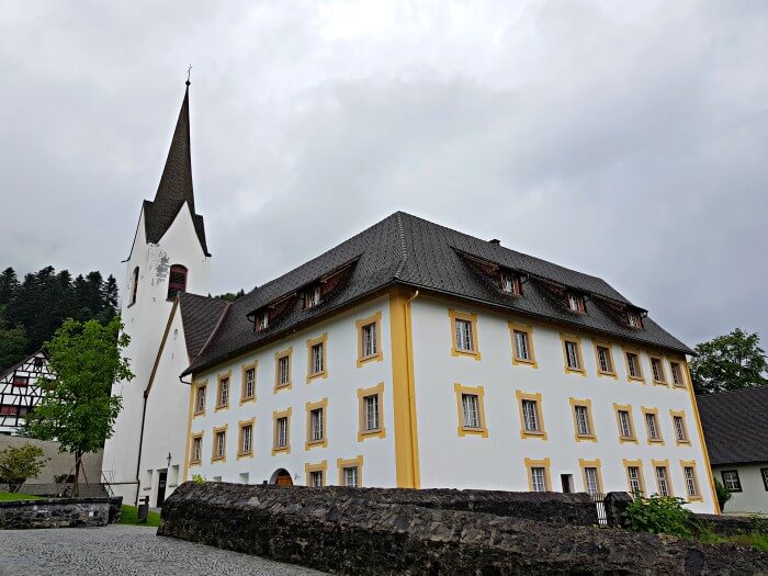
The Propstei St Gerold, a monastery, acts as the cultural center of the Biospärenpark Grosses Walsertal. It’s tastefully renovated and while it still has a functioning church, it now also hosts retreats, seminars and business meetings.
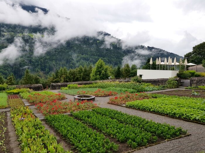
The Propstei has its own vegetable garden and beyond that, you can go for a walk at the large domain. Inside the main building, a maintained room shows how the monks used to live there. The tiny library is worth a look as well and on the ground floor, exhibitions often take place.
Practical information for visiting Propstei St. Gerold
Propstei St. Gerold, St. Gerold 29, St. Gerold
There’s a big free parking lot.
Day 4: Hiking between gypsum holes and picking herbs in Lech
Lech is mostly known as an exclusive ski resort. Few people know that there’s actually quite a bit to do in summer as well.
The famous White Ring ski route, for example, turns into the Green Ring in summer, offering hikers three full days of trails covering a little over 24 kilometers. And then there are the gypsum holes, an ancient natural phenomenon plain in sight, yet so easy to miss.
My experience hiking in Lech
The gypsum holes are a natural phenomenon going back 220 million years. At that time, what is now the Oberlech region was located much closer to the equator and its landscape was dotted with small lagoons. When these lagoons flooded and the water later evaporated again because of the heat, sulfates such as gypsum were released.
As the “Oberlech region” moved northwards, the tectonic plate it sits on collided with the European plate. This collision created the Alps and also pushed the former lagoons up to be part of the mountain ranges. Still today, the gypsum holes evolving.
As green as the rest of the hills around Lech, you don’t notice them at first. It’s only upon closer inspection – and with the guidance of a guide – that you spot them. The terrain around them is sandier than you’d expect and the ground so fertile that flowers here take on the brightest colors.
Hiking around the gypsum holes isn’t that hard. The path is mostly clear and while there are ascents and descents, they’re never too tough to take.
While you can perfectly walk around the are on your own, I highly recommend booking a guide that explains what you’re seeing. I had the pleasure of being taken for a hike by the lovely Annalisa, who just radiated love for the area. She told me all about the plants and flowers we saw, the history of the first settlements there and – of course – how the gypsum holes came to be.
Even though it was drizzling and grey, it was impossible not to get excited with this woman by my side. Plus, look at that landscape!
Practical information about hiking around the gypsum holes in Lech
There are different routes you can take to see the holes. We went up a bit and hiked toward hut Der Wolf. Der Wolf is anything but your classic mountain hut. While its sleek wooden exterior fits perfectly into its surroundings, it stands out because of its modern interior, trendy music and the DJ sessions it hosts in the winter season.
Plus, it offers the best views both from its terrace and from behind the panoramic windows.
If you want to take a guided gypsum hole walk like I did, send an email to info@arlbergalpin.at and ask them about the options during your stay.
My experience picking herbs in Oberlech
One of the things that makes Lech a bit exclusive, is the fine cuisine offered in many of the hotels. Probably more famous than any other is the kitchen of the Burgvital Resort run by chef Thorsten Probost.
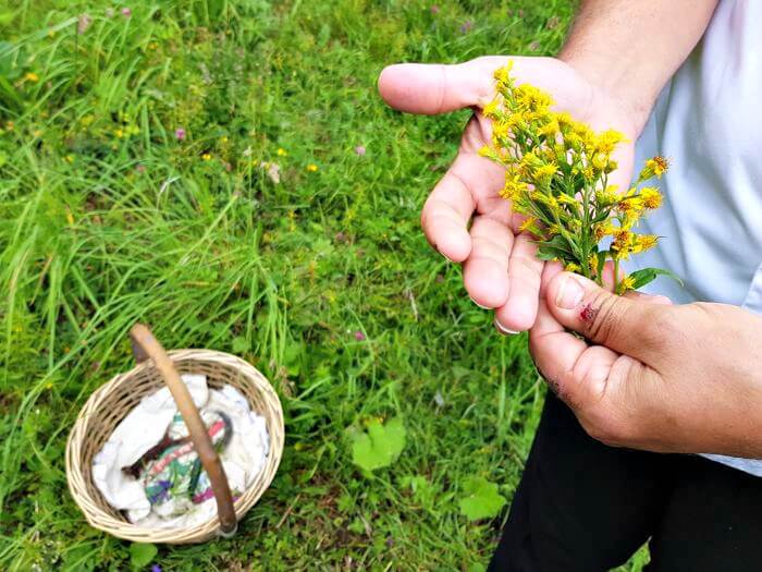
Thorsten is known for working not only with local products but also for extensively using the herbs he finds just outside his door. Guest who stay at the Burgvital for wellness reasons, get their own herbal tea composition to suit their complaints, or they can join Thorsten on one of his many walks.
By the way, while Thorsten doesn’t offer these guided tours a lot, certified herbs teacher and hiking guide Veronika Walch takes visitors with her on her walks every Tuesday morning from June 28 until September 14 (for the 2017 season).
But back to our walk.
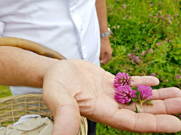
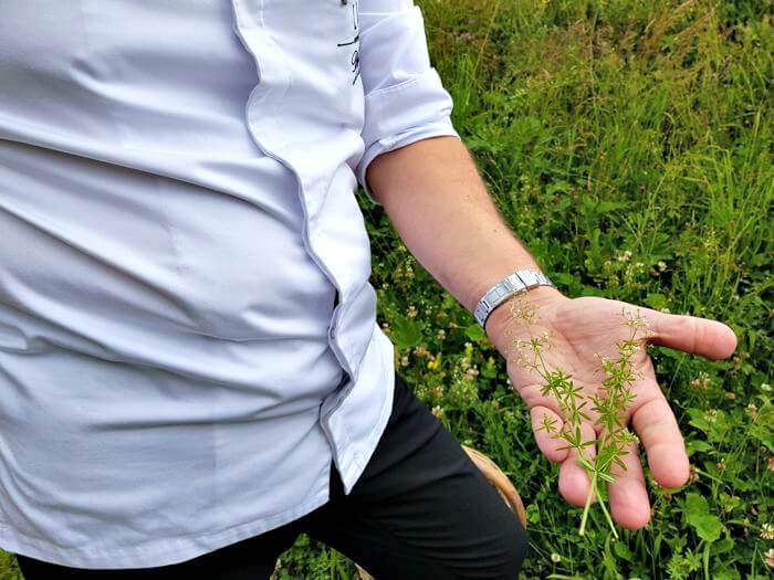
I was lucky enough to be able to join Thorsten on a walk to collect herbs and while I’m more for eating than for preparing food, I was amazed at some of the things he shared. Like that you can only pick certain herbs when the moon is right, or they won’t give you any flavor. Or that most common medicine, like aspirin, can be found right there on the greenlands of Lech in their natural shape.
He picked up one little plant after the other, telling us what it could be used for and how it should be prepared. The man is like a walking encyclopedia and he learned all he knows from Lady Lucian, who founded both the Burgvital Resort and the Burg Hotel – also in Oberlech – together with her husband.
I wish I could have retained it all, but it was just so much information. What I do remember soundly is how I was thinking what a shame it was, that we’ve forgotten so much about the natural world that surrounds us. We go hiking and all we think is “what beautiful flowers” while we’re actually looking at something that could make our headache go away, stop our cold or soothe our aching muscles.
I’m not one to talk about “the good old days”, but I do think it would be wonderful if more people knew how to use nature in a natural way again. I’d rather have a herbal tea than pop a pill when something doesn’t feel right. What about you?
Practical information about the weekly herbal walks
To participate in one of the weekly herbal walks, you need to let them know you’re coming before 4 p.m. on the Monday before your walk. To do so, call 0043 (5583) 2161-0 or send an email to adventure@lech-zuers.at.
The hike is free for owners of the Lech Card, which €24 for 3 days, €40 for 7 days and €68 for 14 days with a chance to extend per day at €4. The card gives you free use of the cable cars in Lech and Warth and of the village bus. It also allows you to participate in a wide range of activities, like themed hikes, for free and gives you access to museums and other places of interest.
Where to stay in Lech
I spent a night at the exquisite 4-star Burg Hotel in Oberlech, a part of the village of Lech that’s a bit higher up in the mountains. I enjoyed a big room, a lovely dinner and quite the breakfast buffet (pancakes!) there.
Aside from lovely rooms, the Burg Hotel has a tennis court, a fitness center, ski-to door-access and an à-la-carte restaurant serving Austrian and international cuisine. The 1,200 m² spa area consists of a sauna, steam bath, indoor pool, and sun terrace with sun beds. Treatments can be booked as an extra.
And for even more relaxation, there’s a lounge, a games room, and free bike hire.
Want to get pampered at the Burg Hotel as well? Check here for more reviews, prices, and availability.
Pin for later
Day 5: Nature meets ar(t)chitecture in the Austrian Bregenzerwald
When you enter the Bregenzerwald in the Austrian region of Vorarlberg, you notice there’s something different about this place. You can’t really put your finger to it, but you feel like the buildings here look a little different, even though they still have that typical Austrian feel.
There’s a mix of modernity with tradition that works remarkably well and while also present in other regions, the Bregenzerwald is the best example of how an open mindset and respect for tradition can go hand in hand to create wonderful things.
Nature: hiking the moorland of Krumbach
It was only 6 a.m. when we met our guide to go for a walk through the Moorlands of Krumbach. Early, yes, but the rising sun quickly became our coffee alternative as we admired its first rays of the day.
We weren’t just there to watch, though. As we made our way 5.2 kilometers through the grass and the forest, our guide kept pointing at plants typical for the moors, telling us what they could be used for.
He told us how people used to use the turf growing in the moor’s puddles for heating and how what’s now still a little pond will be wetland to walk over in a few years time, if we let nature run its course and turf take over.
In the past, people did step in though. Lots of moorland in Krumbach was “filled up” to create gardens and other “usable land”. Luckily, at one point someone mentioned what a shame it would be if the town would lose its typical landscape and it was agreed that what remained of the moors would be preserved.
Now, the people of the are proud of the moors and use them to create products that can only be found in Krumbach. You can book a moor walk with a guide, drink lemonade made with herbs from the moor, eat moor pig meat and drink moor schnapps. There are even four official moor restaurants where the chefs cook using herbs and plants from the moorlands.
One of them is the Gasthof Adler in Krumbach (Dorf 5), where we enjoyed a lovely breakfast after our walk.
Practical information to hike the moorlands of Krumbach
Participation in a guided moor walk costs €8. It’s free for children younger than 14 years old. Walks are organized on different dates throughout the summer and you should call ahead if you want to join.
For all information: 0043 (0) 5513 8157/
Architecture: mixing practicality and art with BUS:STOP Krumbach
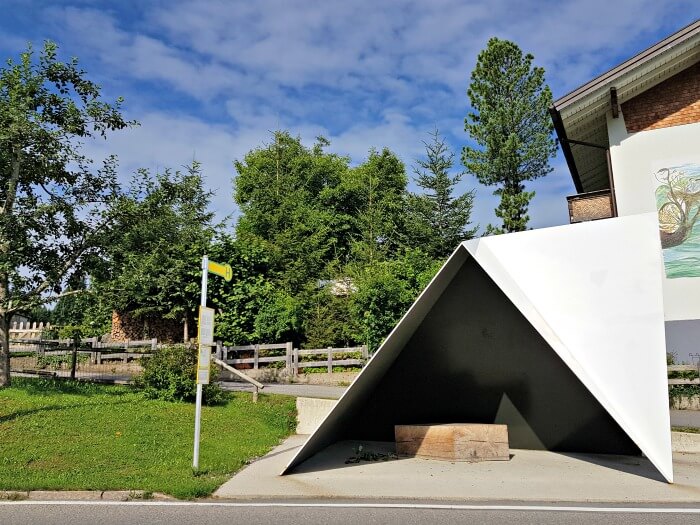
The Belgian BUS:STOP by Jan De Vylder, Inge Vinck and Jo Taillieu and partner architect Thomas Mennel
With a population of just 1,000 people, you wouldn’t expect the mountain village of Krumbach to be a creative hub and yet in some way, it is.
The close-knittedness of the community and the engagement of its members to make Krumbach a great place to live, is what allowed necessary infrastructural works to turn into works of art.
When Krumbach needed to renovate a number of its bus shelters, it did much more than just that. One of the locals saw this need as an opportunity to showcase the region’s building culture and craftsmanship to the world.
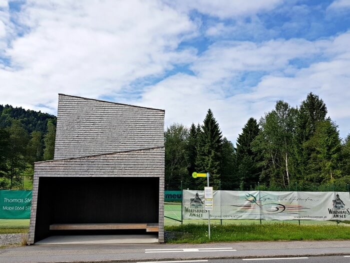
The BUS:STOP by Norwegian architects Sami Rintala, Dagur Eggertsson and Vibeke Jenssen and Austrian partner Baumschlager Hutter Partners Dornbirn
The idea caught fire and the town managed to get Dietmar Steiner, the director of the Architekturzentrum in Vienna on board. He got in touch with the renowned Vorarlberger Architektur Institut and together they selected seven unconventional international architects who weren’t big stars yet, but all stood out in their own way.
Much to everyone’s surprise, all seven architects agreed to work with the village and design one bus shelter. Their fee? A one-week holiday in the region.
Not just the architects worked for free, though. They were paired with volunteering local architects who supervised the works on-site and worked together with craftsmen from throughout the region who employed their skills to make the designs a reality. Sponsors bore the costs for the materials.
None of this happened without the involvement of the villagers. When the architects had sent in their designs, these were elaborately discussed by residents, local business owners, and associations.
Not only was it important that the designs fit the local materials and building techniques, but they also needed to make sure that people waiting for the bus were sheltered from the elements and could see the bus coming without stepping outside the bus shelter.
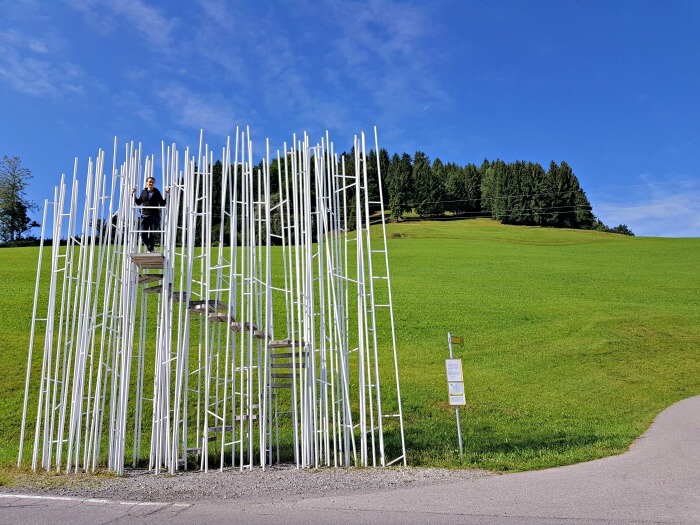
The Japanese BUS:STOP by Sou Fujimoto and partner Bechter Zaffignani Architekten Bregenz
There’s only one BUS:STOP shelter that doesn’t protect against rain and wind and that’s the Japanese one. People loved the design so much, though, that it was accepted anyway. It represents a forest and was one of my favorites.
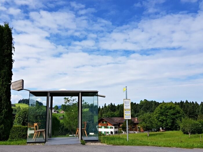
The Chilean BUS:STOP by Smiljan Radic and partner Bernardo Bader Architekten Dornbirn
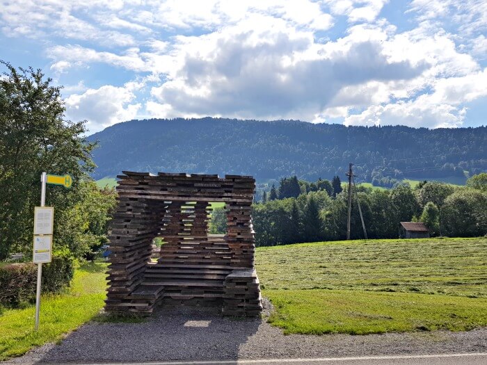
The Spain BUS:STOP by Ensamble Studio and partner Dietrich|Untertrifaller Architekten Bregenz Wien
Practical information to see the bus stops in Krumbach
Three of the shelters are located on the L6. The name of the street is also “Krumbach”, so that isn’t very helpful, but you can enter “Gasthaus Kressbad” into Google Maps as that hotel is located on the L6.
Three others are located on the street that starts as the Unterkrumbach and later becomes the Ladau and the Zwing. Two of them are located opposite each other, the third lies a bit further down the road.
The last BUS:STOP shelter lies on the 205.
The easiest way to get to all of them is to drive to Gasthof Adler, which I mentioned before, as that Gasthof lies on the intersection of the three streets on which you can find the bus stops.
The clash: hiking the Georunde Rindberg
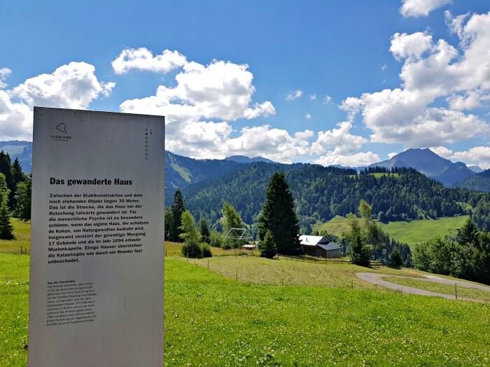
In 1999, architecture and nature did clash in the Bregenzerwald. The mountain land beneath the town of Sibratsgfäll started to slide and left behind a trail of devastation. While they were struck hard by the force of nature, the villagers here too saw a way of turning what happened into something positive.
The Georunde Rindberg is an easy 2.1-kilometer round-hike along which different structures show visitors what happened in the area.
Practical information to hike the Georunde Rindberg
The easiest way to get to the Georunde Rindberg is by using Google Maps and setting it to take you to the Gasthaus Alpenrose. The Gasthaus is the last of the eight stations along the route and has its own parking. There’s also a small parking space a little before you reach the Gasthaus. You won’t miss it as there’s a sign that says “Georunde Rindberg” just before you get to it.
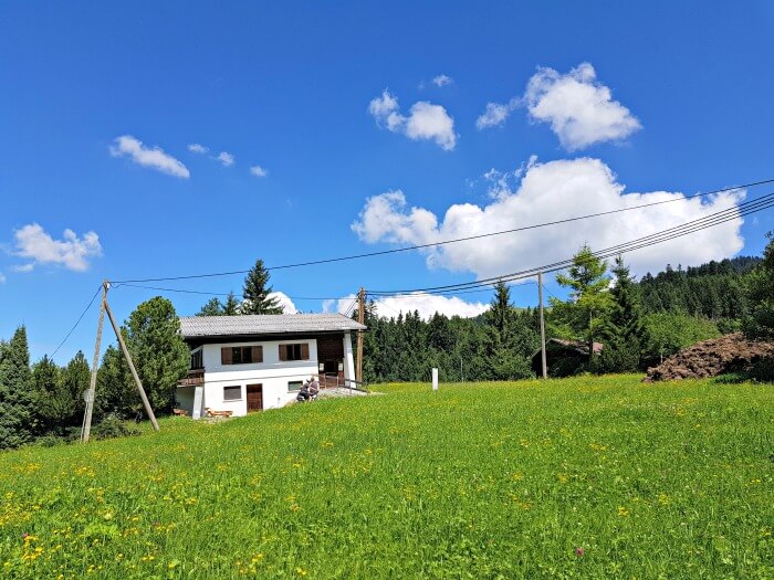
The crooked house
Park at either the parking space or the Gasthaus and then walk back 100 meters or so along the road. To your right, you’ll see the first station of the walk, “Felbers shiefes Haus” or “the crooked house of Felber” with an information panel and a road leading upward into the mountains. This is where the trail starts.
You only need an hour or so to complete it and don’t to wear big hiking boots. Sturdy sneakers or sandals such as Tevas will do.
Where to stay in the Bregenzerwald
I spent a night at the family-run Gasthaus Krone in Hittisau and enjoyed a wonderful dinner at its restaurant. The Gasthaus is just a short drive from both Krumbach and the Georunde Rindberg. Housed in a traditional building, the rooms are bright, with light wood creating tight lines and a sense of quiet. There’s ample parking space in the back and on the square in front of the hotel.
WiFi is free and there’s also a small sauna, a fireplace lounge, a garden and a terrace with a view of the village.
Want to stay at Gasthaus Krone as well? Check here for more reviews, prices, and availability.
Pin for later
Day 6-7: Kleinwalsertal: a hike, a garden and the end of the world
Kleinwalsertal was the last stop of my road trip through the Vorarlberg region in Austria. Like the other Vorarlberg areas I visited, it’s a great summer hiking destination. But it also has a few things that make it unique.
Hiking in Kleinwalsertal
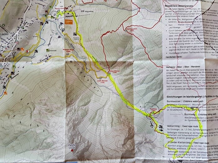
My first activity was a loop hike into Wildental that started right outside my hotel. I didn’t find the exact same hike online, so I marked it on a paper map I took a photo of. Sorry if it’s a bit unclear.
The hike started with a pretty steep but easy – because on a regular road – walk uphill from Gästehaus Wildbach, the hotel in Mittelberg where I was staying, past the Gasthof Alpenrose. The street is called Höfle. At the first real crossing, I followed the arrows to the right in the direction of the Fluchtalpe.
This is where the road – still the Höfle – starts following the Wildenbach river below. You’ll only see the river at certain points, though.
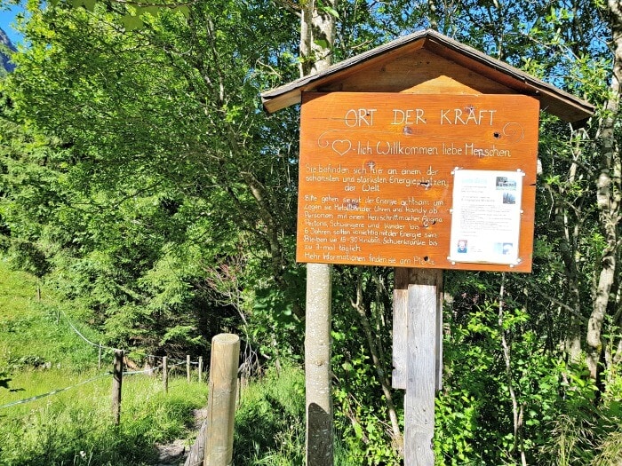
Not too far into my walk, I came across this “energy place” where energy lines are supposed to meet. You can’t really miss it as there’s this sign on the road to your right when you’re coming from Mittelberg, guiding you onto a little path that leads to an open circle behind the trees.
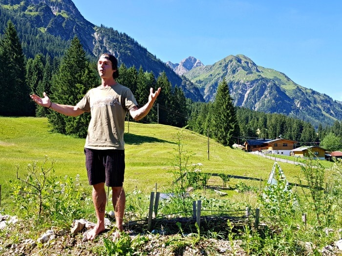
I followed it and once inside the circle, I did my best to understand the instructions someone had left behind in German. When you enter the energy circle, you’re supposed to turn off your cell phone and other devices you may have with you, go stand on the spot that most attracts you with your hand palms facing the ground and cell phone.
I wanted to try it, I really did, but after only a few moments I got uncomfortable.
It wasn’t the being still that made me uncomfortable. I don’t meditate frequently but I’ve had a go at it a few times and didn’t really struggle with the just being still.
This was different, though. I got nervous standing there.
Now, I’m not saying it was the energy at that spot making me nervous. It might have also been the fact that I drank way more coffee at breakfast than I ever drank in an entire day. In fact, it was probably that. Nevertheless, I didn’t feel like standing there for another 10 minutes and so I continued my hike toward the Fluchtalpe.
That went smoothly as the rest of there weren’t any big descents or ascents. It was when I got to the Fluchtalpe that I made a mistake.
You know when you’re driving and you know you’re supposed to turn right but everyone goes left and, as you’re not paying attention, you do too? Something like that happened.
The Fluchtalpe is a hut serving Austrian food and drinks at the end of the Höfle road. The end of the road bends to the left and with a few people walking in front of me, I simply followed it to the left.
What I should have done instead was go straight onto the small dirt path that ran alongside the river. To be honest: I didn’t even see it. To get onto the path, you need to walk through a small opening in the “fence” (it’s really just like a rope) that marks off where the cows can’t go. If you’re not paying attention – I clearly wasn’t – it’s easy to miss.
If you take the path behind the Fluchtalpe, like I did, you’re up for a steep and whirling climb in between the trees. It’s totally doable, but you do need to be in decent shape and mind where you place your feet. The climb isn’t really hilly. It’s more as if someone made steps into the side of the mountain to help you get up. Who knows, maybe that’s exactly what someone did.
I realized my mistake as I was going, but figured it wasn’t a problem. This was a round hike after all and so instead of going counter-clockwise, I could now just go clockwise. Right?
At one point, all the way up there, I reached a crossing with some direction signs. One pointed in the direction of Germany, the other toward the Hinterwildenalpe. Looking at the map I had with me, the latter was where I needed to go.
I continued my hike onto a narrow path that led me a little higher until I reached another hut. When I got there, there seemed to be only one possible path to take and so I took that one. In the distance, I could see the waterfall and I knew I had to cross that at some point to then go down again on the other side of it.
The path in front of me seemed to go in the right direction but it got narrower and narrower as I went along, with the mountainside to my left and a dangerously steep-looking slope to my right.
And then I reached The Rock. The Rock was literally that: a piece of rocky mountain that clearly did not have a hiking trail run over it. Hooks to attach climbing gear, yes, those were present, but no sign of the path continuing.
I stood there, a bit puzzled, and looked at my map again. I was clearly going in the right direction and yet I was also clearly on the wrong trail. This was supposed to be a medium hike, no climbing involved.
As my fear of heights had kicked in at this point and I didn’t want to take any unnecessary risks, I decided to turn back.
When I got to the hut again, I looked around to see if I could spot another path but nothing.
As I was writing this post, I needed to find out where I’d gone wrong and so I studied Google Satellite and did find another trail departing from that hut and running parallel with the path I took, only this one went over the top of the mountain, above The Rock.
It seems super easy to spot on the image and yet I totally missed it. I don’t know if it was one of those tiny “rope gates” again or if my brain was just malfunctioning after a week of travel, but not knowing where else to go, I simply went back the way I came.
As I reached the Fluchtalpe again, it was now clear where I’d made my mistake. It was later in the day and now several hikers were taking the path up alongside the waterfall. Tired as I was at that point, I went up a few meters just so that I could take this photo for you to show you what it looks like when you go the right way :-D
Instead of doing a hike that was supposed to last about four hours, I left at 9.30 in the morning and only got back to the hotel at 2.30 in the afternoon – not having even stopped for lunch.
And yet, I don’t mind too much for several reasons.
- I got a good workout, climbing up and down the left side of the trail.
- I was confronted with my fear of heights again, but also realized that a few months ago, I would have been way more scared on some of the parts of the trail than I had been this time. Seems like all of my hiking in the Austrian mountains is paying off :-)
- While it had been nicer, of course, to do the full loop, the left side gave me the best views of the waterfall and allowed me to take some cool photos.
If you do this hike – even if you do it the right way ;-) – make sure to wear sturdy hiking boots. The first part of the trail is flat and easy but then it gets uneven. Check here for more tips on what to wear in Austria in summer.
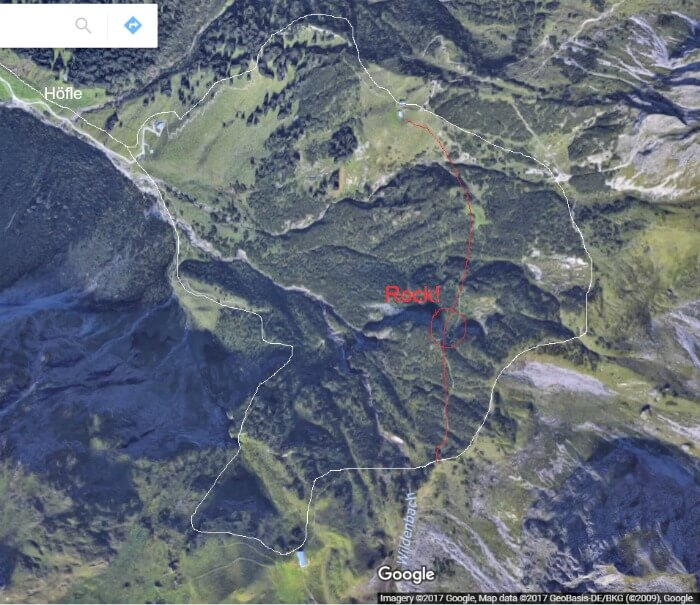
The full hike and which way not to go :-D
Baad, the end of the world
I was actually supposed to go on a seven-hour sunset hike that evening as well, but you can imagine my body wasn’t up for that after my longer-than-planned day hike. So instead, I joined Elmar from the Kleinwalsertal Tourism Board for a picnic in Baad.
Baad is also known as “the end of the world” because it’s the place in Kleinwalsertal where the roads end. If you want to go any further, you need to hike or bike. Luckily, there are plenty of great hiking trails in this area as well.
If you want to explore them, the easiest is to drive to the one parking lot Baad has, which is located at Baad 1, A-6993 Mittelberg. It costs around €3/day to park there and there’s a trail that starts right at the parking lot.
Andi and his permaculture garden
I had one last stop in Kleinwalsertal the next morning before I needed to head home again: Andi’s permaculture garden.
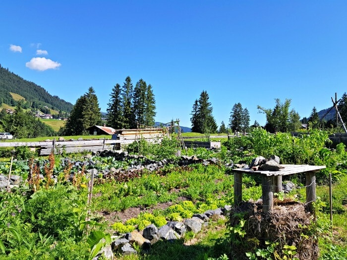
On a patch of green land along the Wildentalstrasse in Mittelberg, lies a unique garden. Owner Andi created it now six years ago as a permaculture garden, a garden designed not to be pretty, but to reflect how plants, herbs and vegetables interact with each other in nature.
Andi lives from what he grows in his garden and his vegetables are of such high quality that the chefs of local restaurants love using them.
When I visited him, I did so together with a group of marketing students who were working on a project to promote the safekeeping of bees. They wanted Andi’s advice on how they could best create bee-friendly flower installations around Kleinwalsertal. It was incredible hearing him explain all the options and the things to take into.
Just like during my herbal walk in Lech earlier that week, I was reminded of how much nature has to offer us if we just take the time to learn about its workings and make the effort to put that knowledge to use.
Furthermore, Andi progressively stepped away from consumerism by reusing as many things as possible, growing his garden and only buying – or even trading – the things he really needs. What I loved was how he told us all this while emphasizing that he does not want to push his way of life onto anyone, but simply wants to show people that there’s another way.
It definitely gave me something to think about during my drive to the airport.
If you want to visit Andi and his garden as well, you can do so from mid-June until September 26 (date for 2017) every Tuesday at 1.50 p.m. He won’t just tell you about his garden but also teaches you how you can do small things in your own garden.
My Kleinwalsertal hotel
I spent two nights at the Gästehaus Wildbach, a small hotel in Mittelberg im Kleinwalsertal in a lovely room with a view of the valley. The Wildbach serves a lovely breakfast buffet in the morning and has a trust-based fridge full of cool drinks that guests can make use of.
All rooms have a balcony and are equipped with satellite tv and a water kettle. WiFi is free and guests can make use of the garden with playground. There’s a restaurant just a two-minute walk away.
Want to stay at the Gästehaus Wildbach too? Check here for more reviews, prices, and availability.
Webcam Kleinwalsertal
If you want to get an impression of Kleinwalsertal at this very moment, check out the Kleinwalsertal webcam page. There’s a Mittelberg webcam for the place where I stayed and more than 40 others.
Pin for later
How to travel to Vorarlberg
I flew from Brussels Airport in Belgium to Zurich Kloten Airport in Switzerland with Swissair. There I
rented a car to explore Vorarlberg with for a week. You do really need a car to explore Vorarlberg, so if you’re not driving to the region from wherever you’re coming from, I highly recommend renting one.
Check RentalCars.com as they compare prices and conditions for over 900 rental car companies.
If you’re flying in and still need to book your flight, check Skyscanner for a good overview of all of your options and their prices.
Don’t forget travel insurance
Plan for the best, prepare for the worst. Travel insurance has you covered in case (part of) your trip gets canceled, you get sick or hurt abroad, and sometimes even when your electronics break or get stolen. I always make sure I’m covered on every trip I go on.
Don’t have travel insurance yet? Check out SafetyWing. They offer super flexible plans that you can even sign up for while you’re already on your trip. On top of that, they were the first travel insurance to cover COVID, and when I got COVID, they reimbursed all of my expenses without making a fuss. Their customer support team is great and I can personally recommend them.
PIN FOR LATER
I was invited to explore Vorarlberg by Vorarlberg Tourismus. As always when I take on collaborations like this, I was free to write what I wanted.


Neele says
It looks so beautiful!!
Neele
Sofie says
It’s a beautiful region :)
Evi, Journey Behind The Postcard says
Hi Sofie,
I loved reading this post as I studied for one year in Dornbirn, Vorarlberg. My favourite place in Vorarlberg is the Lünersee!
Sofie says
Hey Evi!
So nice of you to leave a comment here :)
I haven’t been to Dornbirn yet. Will have to look it up. The Lünersee was definitely a good first stop on my trip. SO pretty! It really set the tone :)
Samrat says
A great trip and a great post Sofie!
I am very interested to know more about this: “It definitely gave me something to think about during my drive …”
Sofie says
Well, I thought about it :) That doesn’t have to mean I came to a conclusion. Alternative ways of living and generating food and income interest me but thinking about them doesn’t always immediately lead to something :)